Identifying Opportunities: Geospatial Analysis as a tool for targeted redevelopment
Posted on April 19, 2016
Rachel Ryding, Research Assistant
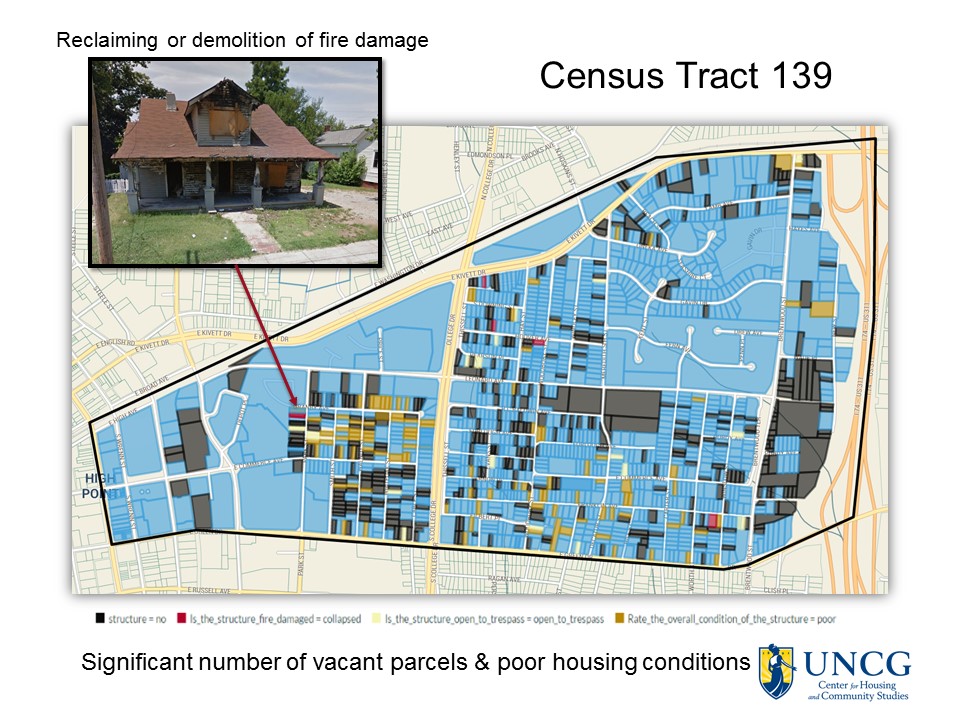
Vacant and abandoned properties are often indicative of economic distress and disinvestment in a neighborhood. Their existence presents a complex set of problems for the surrounding community, including increased crime rates, greater incidences of asthma, and decreased property values. Additionally, the presence of vacant spaces increases the likelihood of long-term, cyclic disinvestment and deterioration.Thus, revitalization efforts may be most effective when deployed in areas with high concentrations of vacant spaces. The city of High Point, North Carolina, also known as the furniture capital of the south, has experienced notable decline as manufacturing has been globalized and competing furniture trade events have opened in Las Vegas and New York. The Core City area has been especially hard hit as residential areas (many historic mill villages) were linked to manufacturing. The area has been the subject of numerous revitalization plans since the 1960s; yet, housing and neighborhood conditions continue to deteriorate. The area is overwhelmed by substandard housing, high vacancy rates, empty lots, and affiliated low property values, high poverty rates, low homeownership rates, and high crime rates. As one-third of the total population of High Point lives in this core city area, this rate of vacancy and abandonment negatively impacts a significant portion of High Point residents. Researchers working with the Center for Housing and Community Studies (CHCS) at the University of North Carolina at Greensboro remotely gathered over 15,000 parcel-level assessments as part of a housing market segmentation study of this area. Researchers developed an external assessment tool that employed new GIS applications developed by Loveland Technologies to conduct assessments in nine census tracts. Researchers found high concentrations of vacant and abandoned properties in some of the surveyed census tracts. This data was then overlain with geospatial data from the U.S. Census, HUD, EPA, and the City of High Point to evaluate the specific effects of these vacant and abandoned properties in the local community. The findings of this project will be used to target redevelopment efforts and improve its distressed communities. This paper will review the literature on reclaiming vacant properties, examine the parcel-level data produced in the study, and review best-practices for market stabilization and revitalization in small/medium sized towns with limited resources.